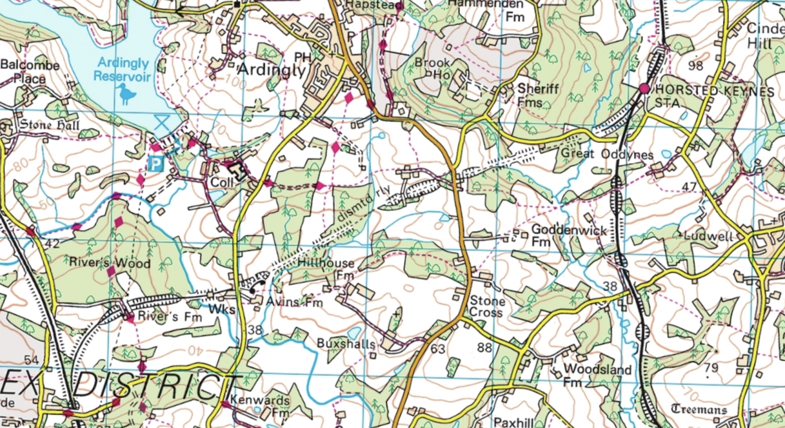
I spent this Easter Sunday in Ardingly, and the previous night the discussion was focused around the proposed extension of the Bluebell Railway to utilise the disused link from Horsted Keynes to Haywards Heath. We were studying the local OS map, and didn’t see how the route would go through a set of houses on the Lindfield Road. All the aerial views suggested they were right in the way of the railway, and the OS map wasn’t clear as to whether they lay in or on the cutting created for the railway - they are 1-4 Railway Cottages, and we thought there was every chances there were built in the flat bed left by the railway after it was ripped up, or perhaps on a giant spoil pile that filled in the cutting when they wanted to create the road.
We hoped to clear up this mystery. :)
 The OS map
The dismantled railway section runs from the old Ardingly station in the west (now an aggregates yard) to the end of a spur coming off from the Horsted Keynes junction.
It turned out that the Horsted Keynes spur ends as soon as the land drops away from the raised embankment next to the road, where once stood Sheriff Mill viaduct - now long since disappeared.
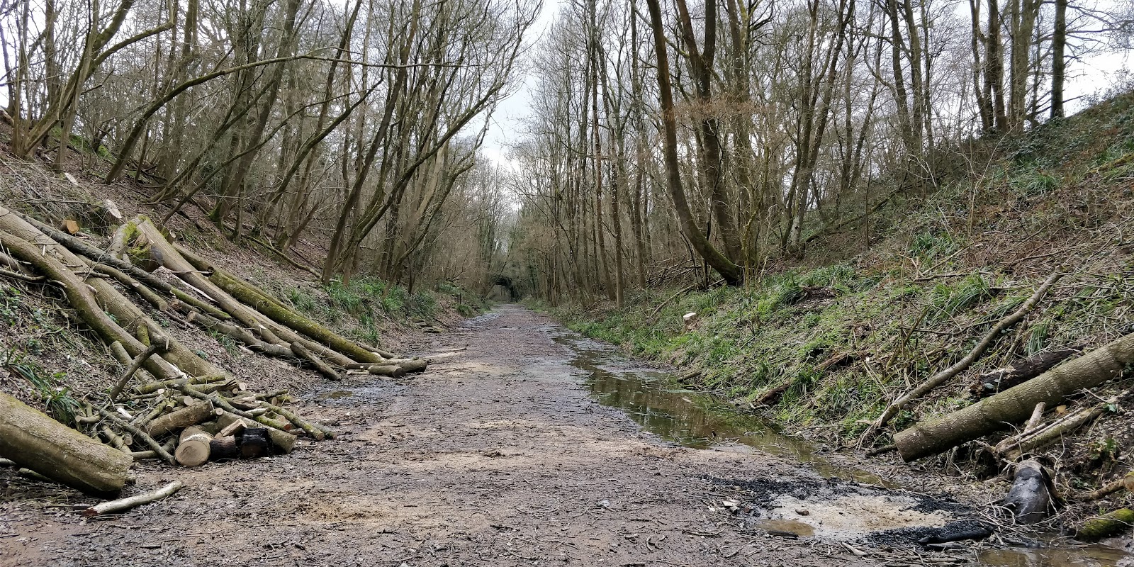
We then went to checkout the Lindfield Road crossing, where we went to seek a tunnel. The aerial maps of the area showed the treeline of the old railway, but it was impossible to determine relative heights of anything. We parked up near the railway cottages and headed down a small road to see if we could find the western portal.
We had a short wander through a wooded area and started seeing the middle of trees, rather than the bases, a sure sign of the ground steeply dropping away, and lo and behold!
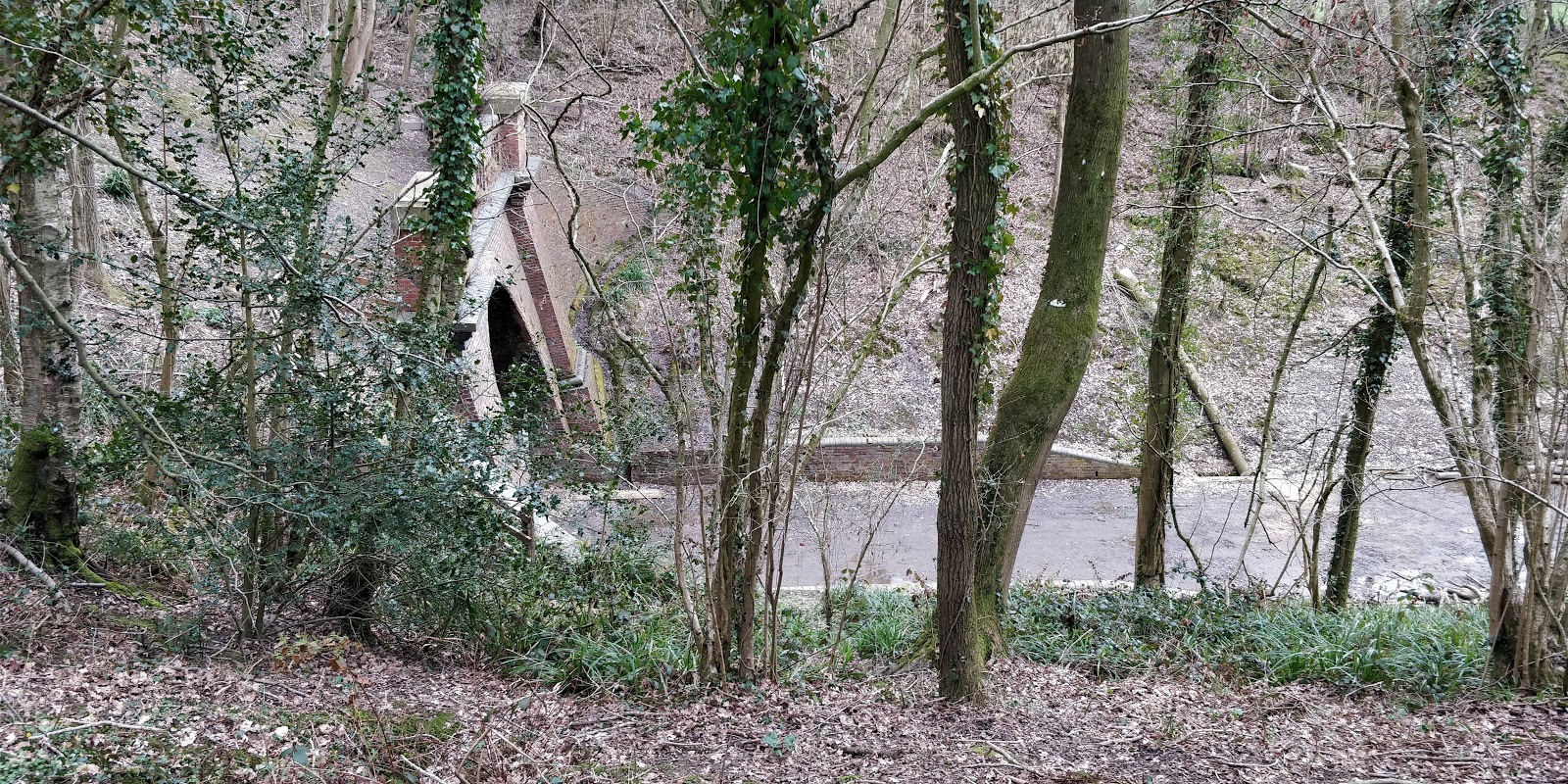 First sight of the western portal of the Lywood tunnel
We were very surprised to see the old track bed quite to clear - and with evidence of tree felling, there seems to have been work to clear up the area very recently.
Partly scrambling down the slippy bank I made it to the bottom.
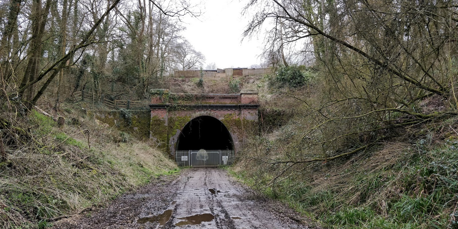
 Lywood Tunnel, Western Portal, complete with gates
The fencing and gates alas prevented my jaunt going into the tunnel, but it was very nice to see the entrance in such good condition - the brickwork looked excellent!
 Peering east through the railing
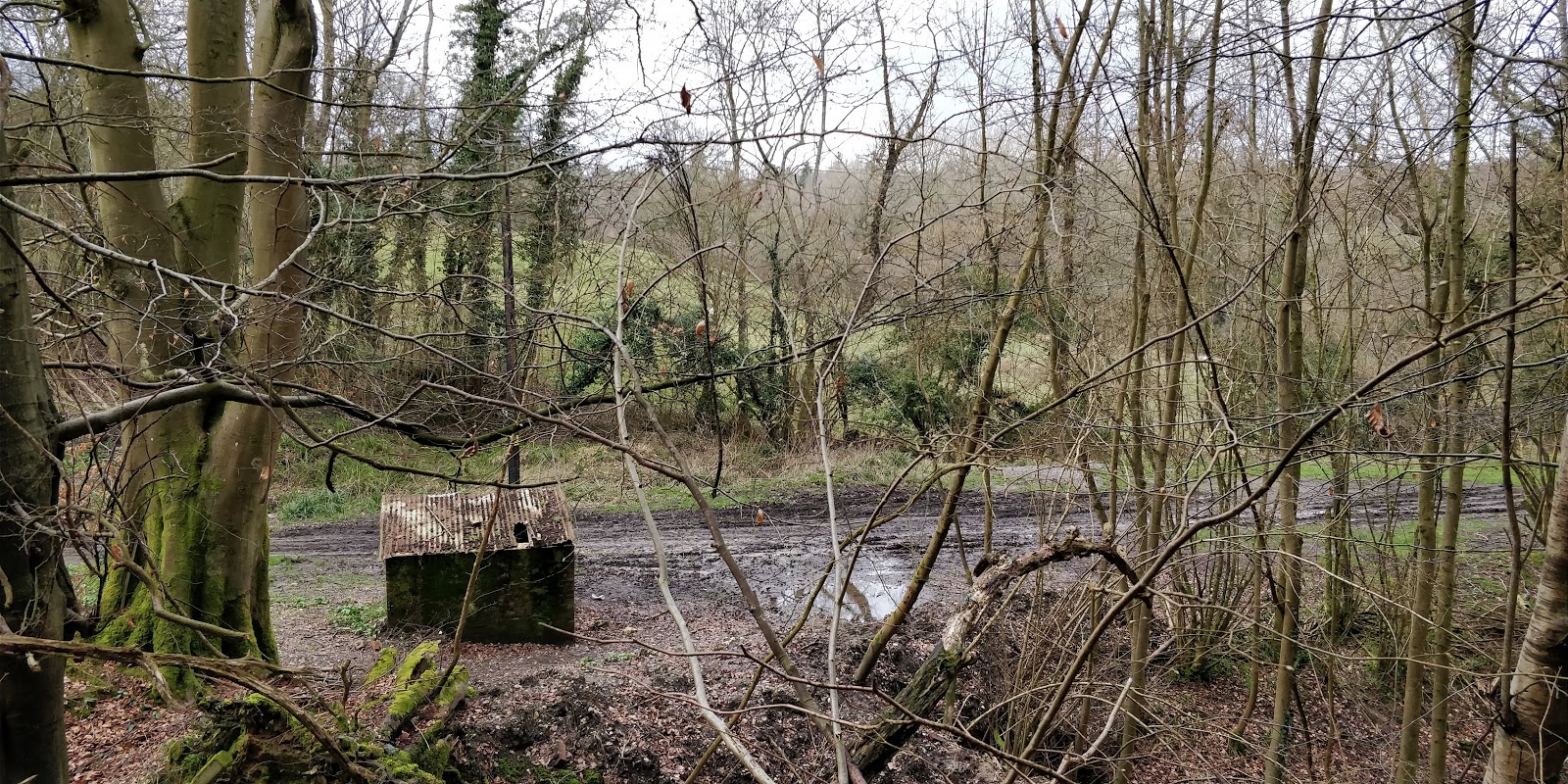
It was here that I realised the tunnel had a name - Lywood Tunnel, taking its name from the local farm and common.
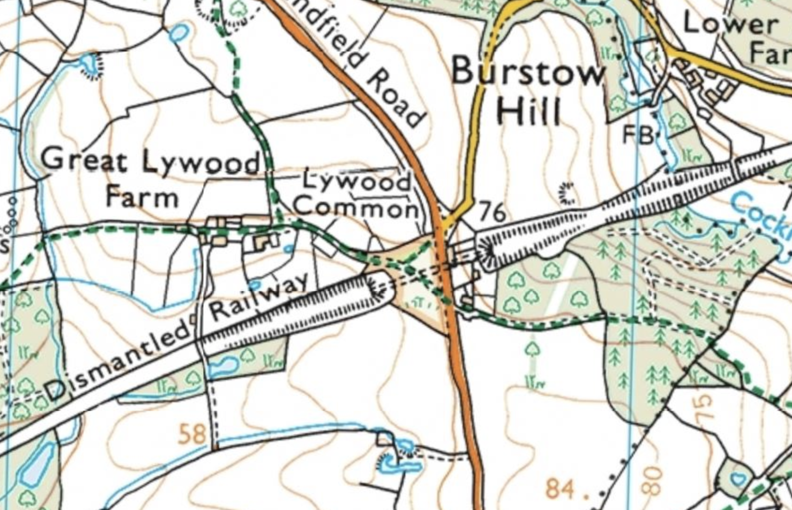 Lywood Farm and Common
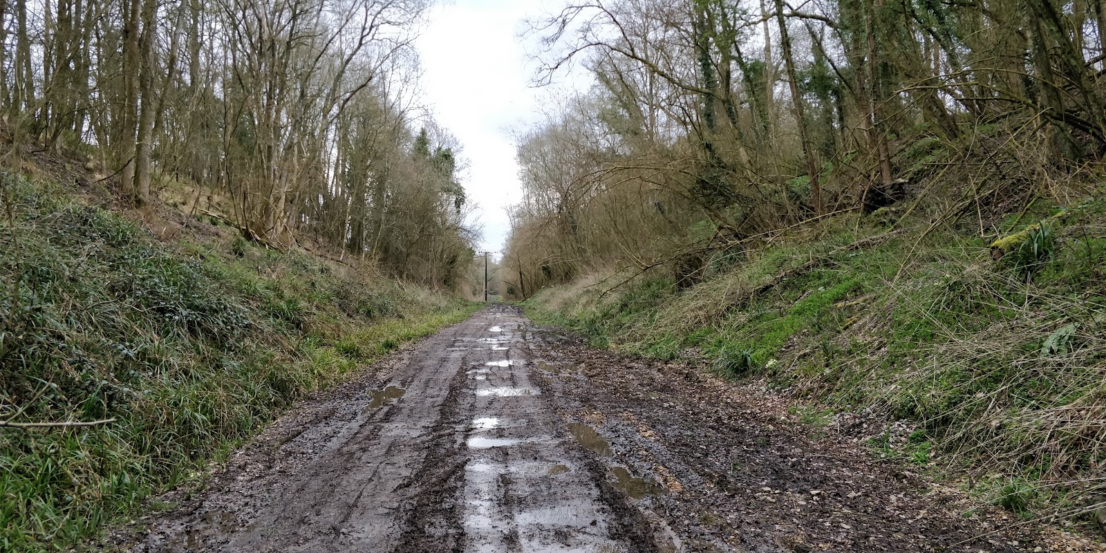
The track bed was really clear, but very muddy, so I didn’t venture far, but there was a bridge not too far away - perhaps on another visit I will find out if you can get to it from the road marked on the map.
 Looking west
The tunnel was also leaking. There was quite a lot of water pouring in from the roof on to the floor below. It may have been less bad than it sounded, instead having been amplified by the shape of the cavernous nature of the tunnel, but either way it was no longer watertight (assuming that it once was!).
Heading back up the bank, I crossed the road and headed round the back of the houses, through a wooded area and along a clear strip shown on Google Maps which turned out to be the path of some small 3-cable electricity pylons. The trees here were incredibly regular, and judging from the diameter of the trunks could have been planted 20-30 years ago. They were pretty close together, so perhaps someone is farming them. Eventually I came upon a small hut:
 First sight of the track bed to the east of Lindfield Road
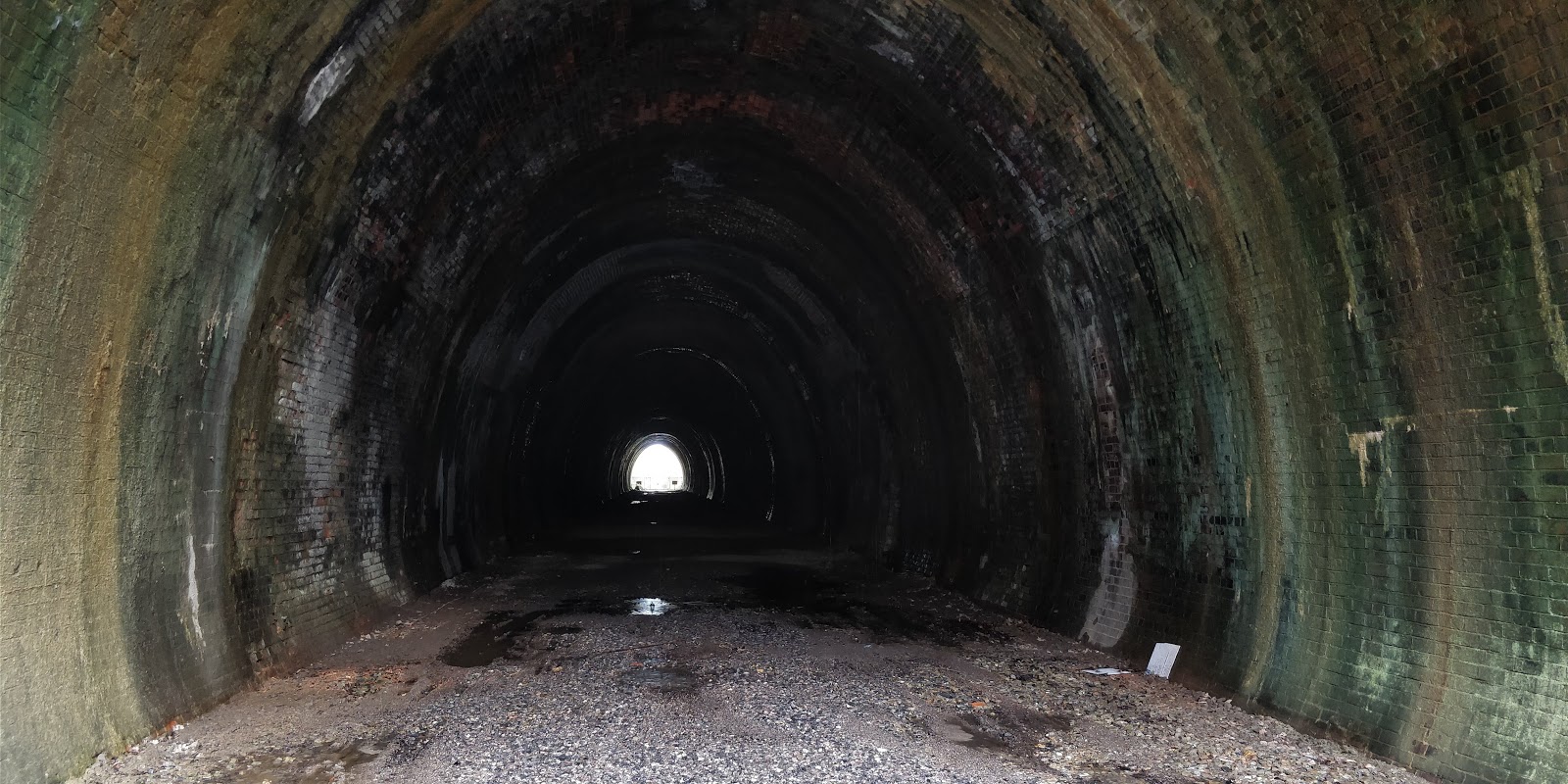
It was very muddy around here. Getting down to the track bed and turning left, I saw the tunnel and headed towards it.
 Lywood Tunnel, Eastern Portal
Once again the brickwork was in remarkably good condition, although there was noticeably more moss and vines on and around this structure.
 Looking east towards Horsted Keynes
And there we go - mystery solved!
It seems a lot of work has been done to clear the way for track to be laid - perhaps the main challenge now is to rebuild the viaduct, and work out how to run trains to a station at Ardingly again, given that the building is now used for the offices of the aggregate works, and the station has apparently been all ripped up.
Perhaps next time I’m here, in the summer maybe, I’ll try and walk the length of the proposed extension and see what kind of state the rest of it is in.
As as some special bonus content, here is a picture of one of the trains we saw at Horsted Keynes this afternoon:
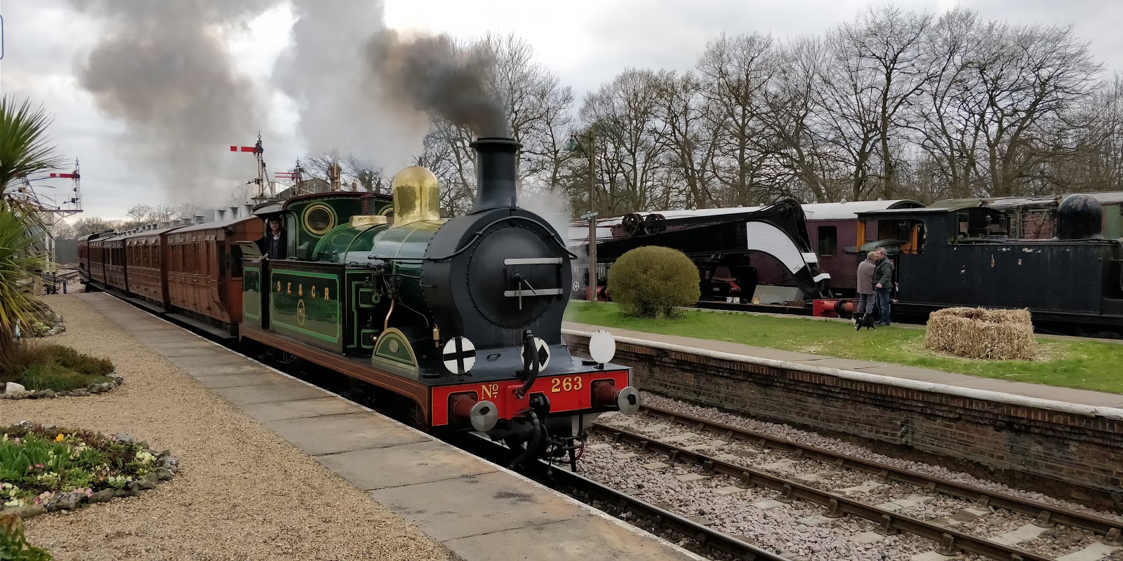 Horsted Keynes to Sheffield Park passenger service